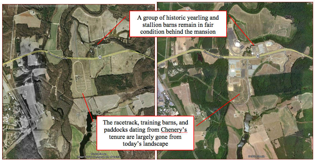
Maps Published May 16, 2012 at 1008 × 516 in Secretariat’s Virginia Roots: The Meadow Farm to be Auctioned on May 22nd Satellite imagery illustrates the farm’s transition to host the SFVA. Pictured at the left is an aerial view of the farm in 2002, and at right, an image taken in 2010 (Google Earth).